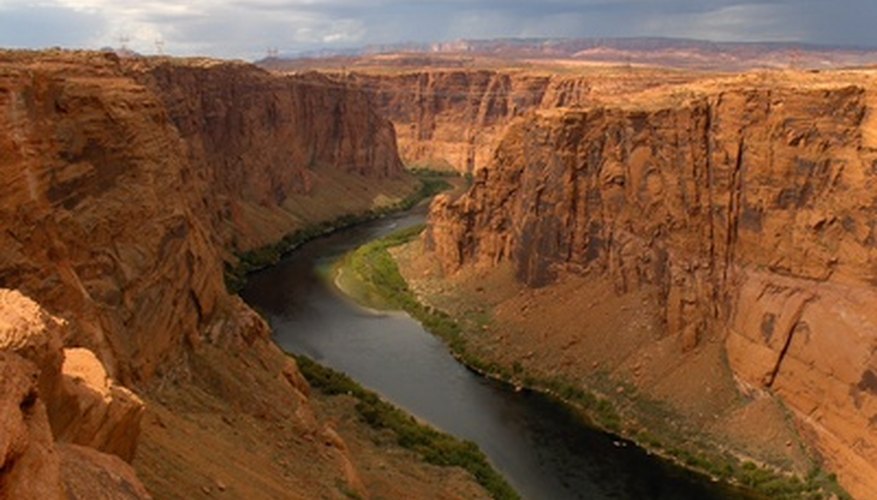


Willow Beach, located one hour from Las Vegas on the Arizona side of the Colorado River, is ideal for trout fishing because of the 750,000 trout released each year from the National Fish Hatchery. You'll love the water, with temperatures up to 20 degrees cooler than Lake Mead, as you boat the short 11 miles through the Black Canyon to Hoover Dam.
When
The best times to fish Willow beach are Fridays as trout are released most Friday mornings into the Colorado River. Due to high temperatures during the day, many anglers fish at night, often fishing through the night.
Where
You can fish off the shore for smaller fish or rent a boat and head to deeper waters where 20 and 30 pound big striped bass are common. Fish the canyon walls for some of the larger fish and the weeds near shore for some of the smaller ones. Head to Las Vegas Bay and the Black Canyon for your best chance to catch striped bass. One of the best offshore fishing spots is downriver from the fish hatchery where many anglers congregate to catch the fish as they are released.
Fish Varities
You'll find a variety of fish including bluegill, rainbow trout, largemouth bass, black crappie, channel catfish and striped bass. Both the razorback sucker and bonytail chub are endangered. If you catch one, throw it back and contact the National Park Service about the catch.
Bait
The best bait to catch rainbow trout includes cheese and mashmallows in the deeper, colder parts of the water. Use minnows and worms for blugill, minnows, lures and nightcrawlers for largemouth bass, and minnows and crickets for black crappie. If you want to catch catfish, prepared or natural stink bait is best.
Fishing Regulations
You must purchase a fishing license for all persons fishing unless they are under 14 years old or blind. Bag and possession limits are strictly enforced to protect the fish populations so check with the Arizona Game and Fish Department for a complete list of restrictions.
References
Writer Bio
A native of Houston, Laurie Roddy is a freelance outdoor writer with over 25 years writing experience. The main topics that she prefers to write about include hiking, golf, paddling, and traveling. She is a contributing writer for "Cy-Fair Magazine" and writes regularly for several websites. Roddy attended the University of Houston receiving a journalism degree. She has written "60 Hikes Within 60 Miles: Houston."